Product Spotlight: The Wndsn Cold War Berlin Wall "Silk" Escape Map
2024-12-04
Escape maps were an essential object during World War II. It could be used as a part of a solider’s kit, intended to assist in performing escape or evasion behind enemy lines. Or it could be smuggled into POW camps, providing prisoners an ingenious method to facilitate escape.
Today, these escape maps are called Evasion Charts (EVC) and continue to be provided in modern materials and with custom, context-dependent information added to the map sheets such as:
"survival data relevant to the geographic areas they represent, such as navigation and travel information, celestial navigation aids, climate data, lists and pictures of edible and poisonous plans and animals, food preparation instructions, suggestions for sources of water, first aid procedures, and descriptions of environmental hazards". (Source)
On the occasion of the 35th anniversary of the fall of the Berlin wall in 1989, Wndsn releases a commemorative edition of an escape map.
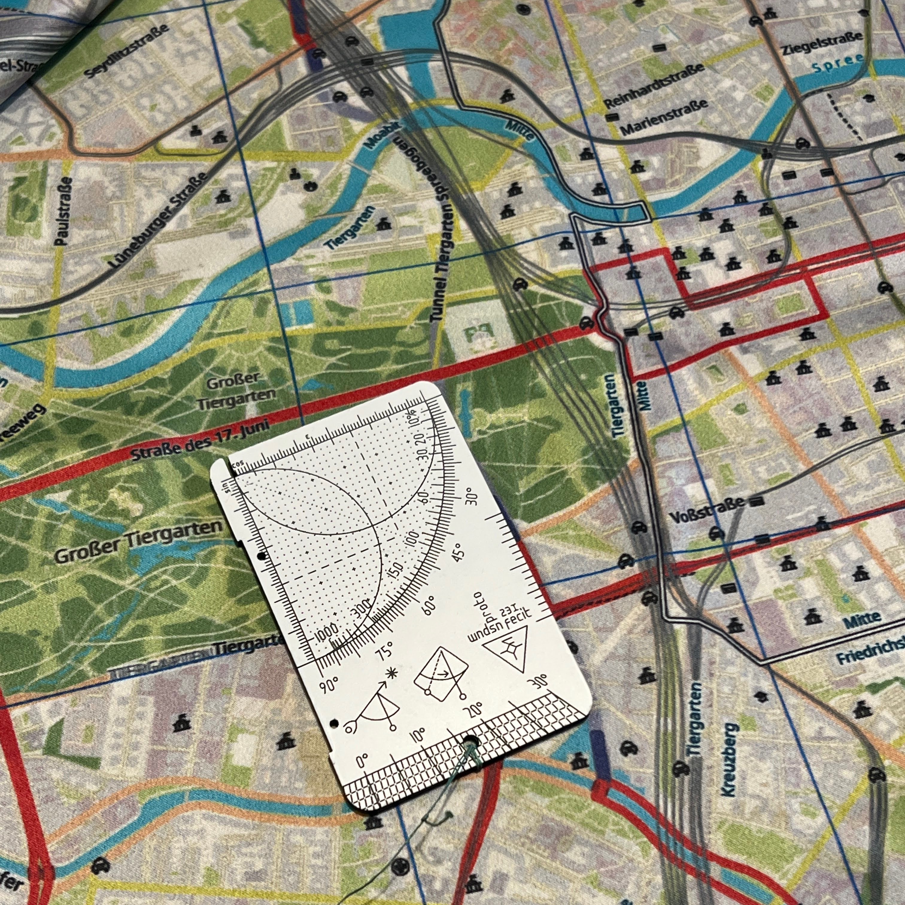
Using the inch scale of a Wndsn Telemeter to determine a distance on the map.
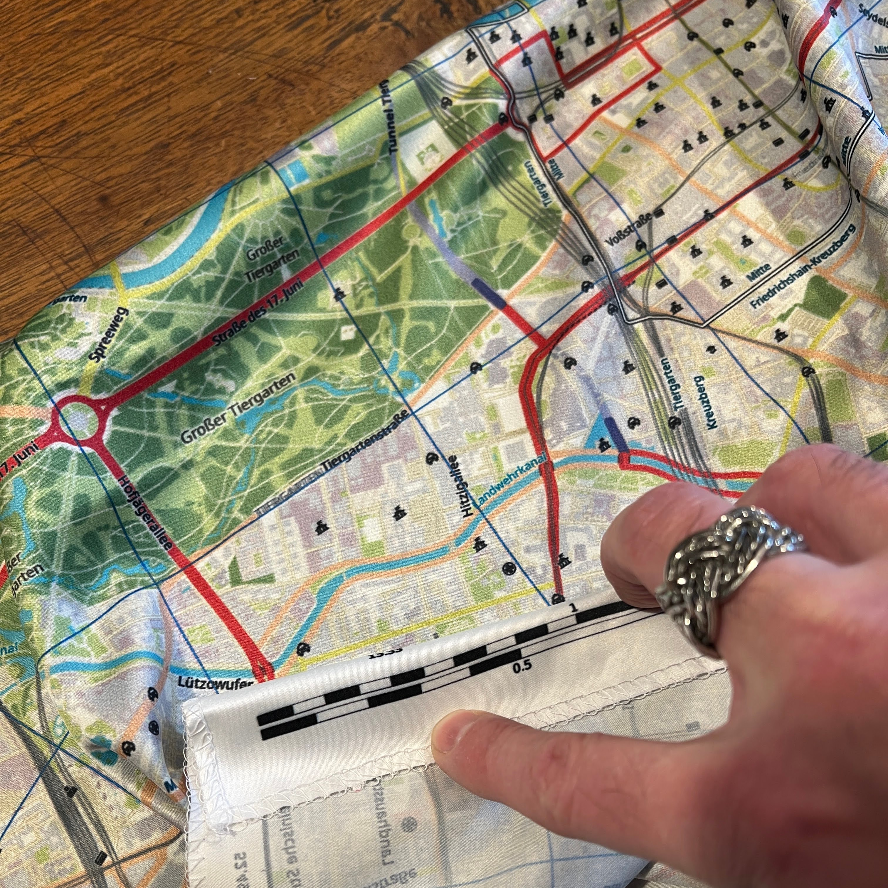
Using the printed scale on the escape map itself.
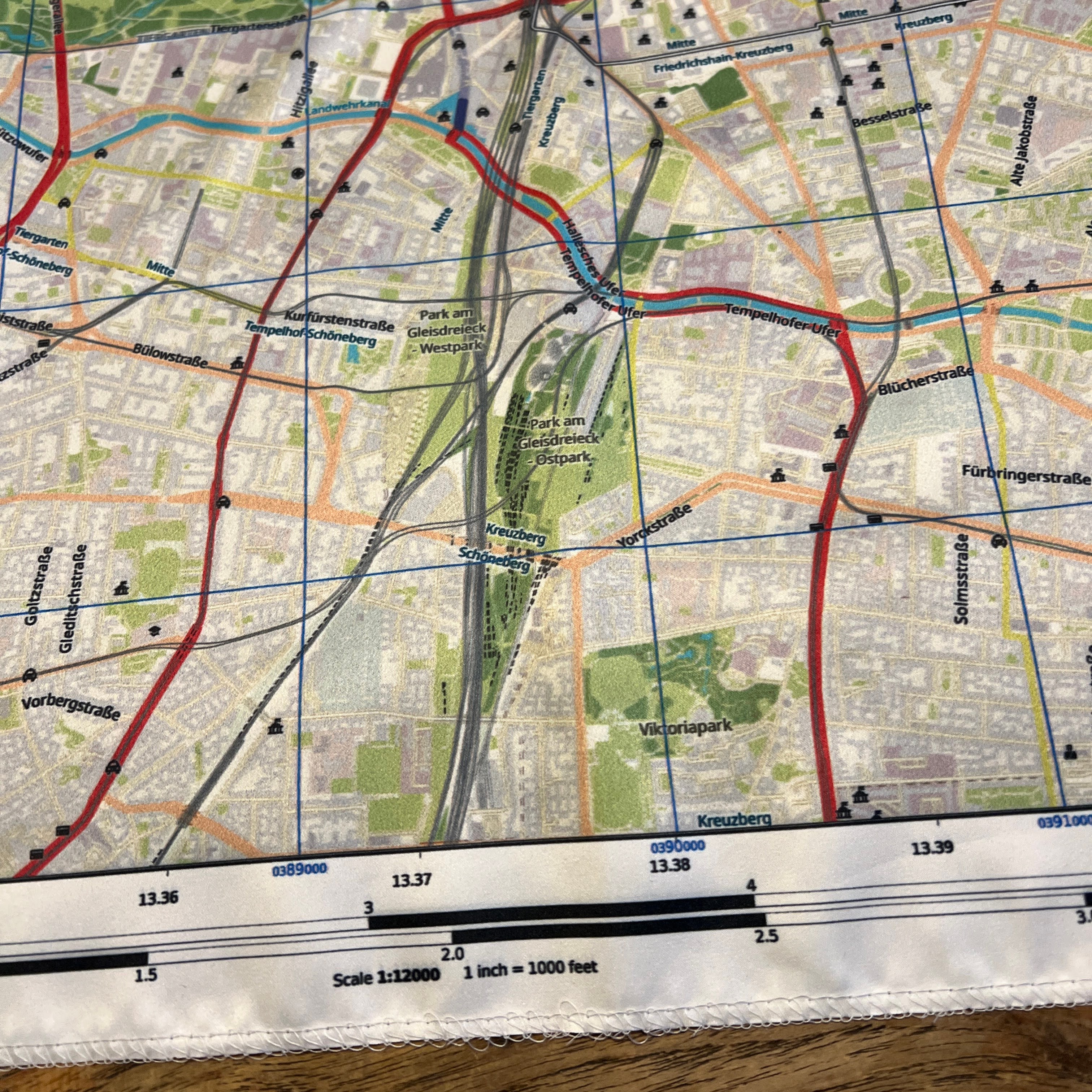
The Berlin escape map is not a reproduction, Instead, it is an "impossible map"; a current map of the center of the city with an added trace of the long gone Berlin wall. The scale is 1:12,000, where 1 inch equals 1000 ft -- and 1 cm equals 120 m.
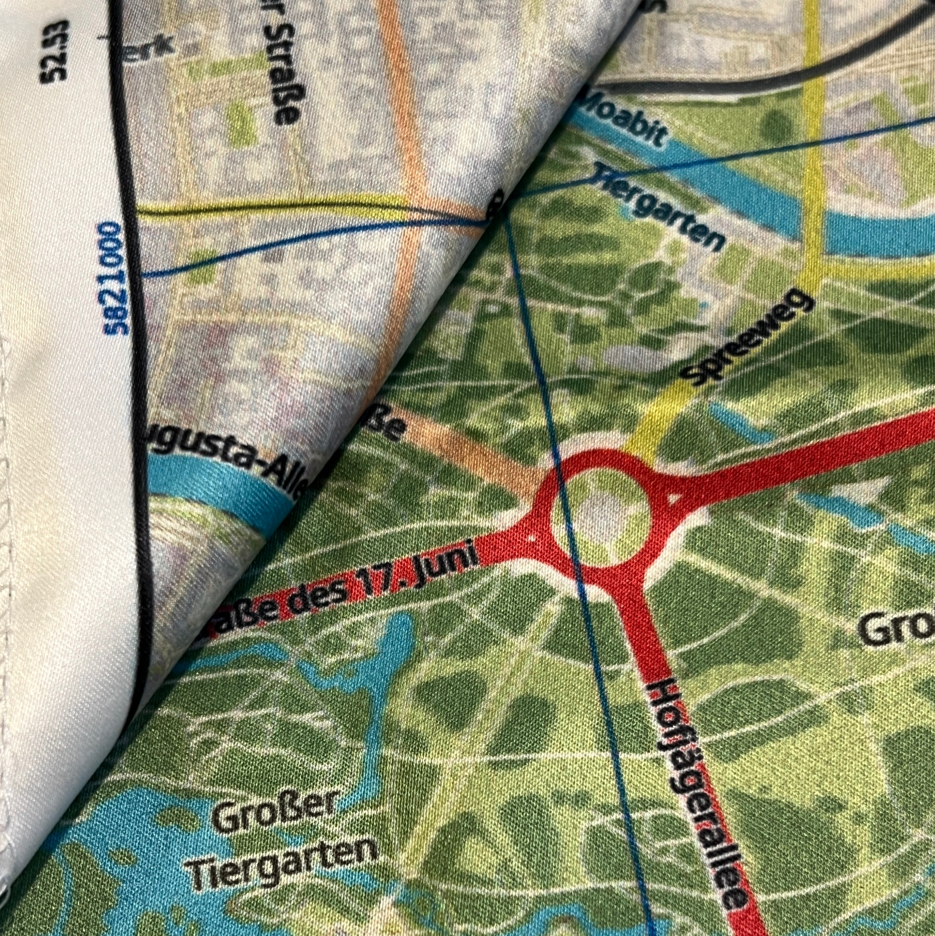
Berlin escape map detail: Note the trace of the Berlin wall at the top of the picture.
Berlin escape map detail: Note the UTM grid and degrees around the edges.
Historic examples have been produced at rather large map scales, at 1:250,000 and even 1:500,000. The Wndsn escape map comes in a much more detailed scale, to aid in locating and navigating urban features. A 1:24,000 version is available upon request.
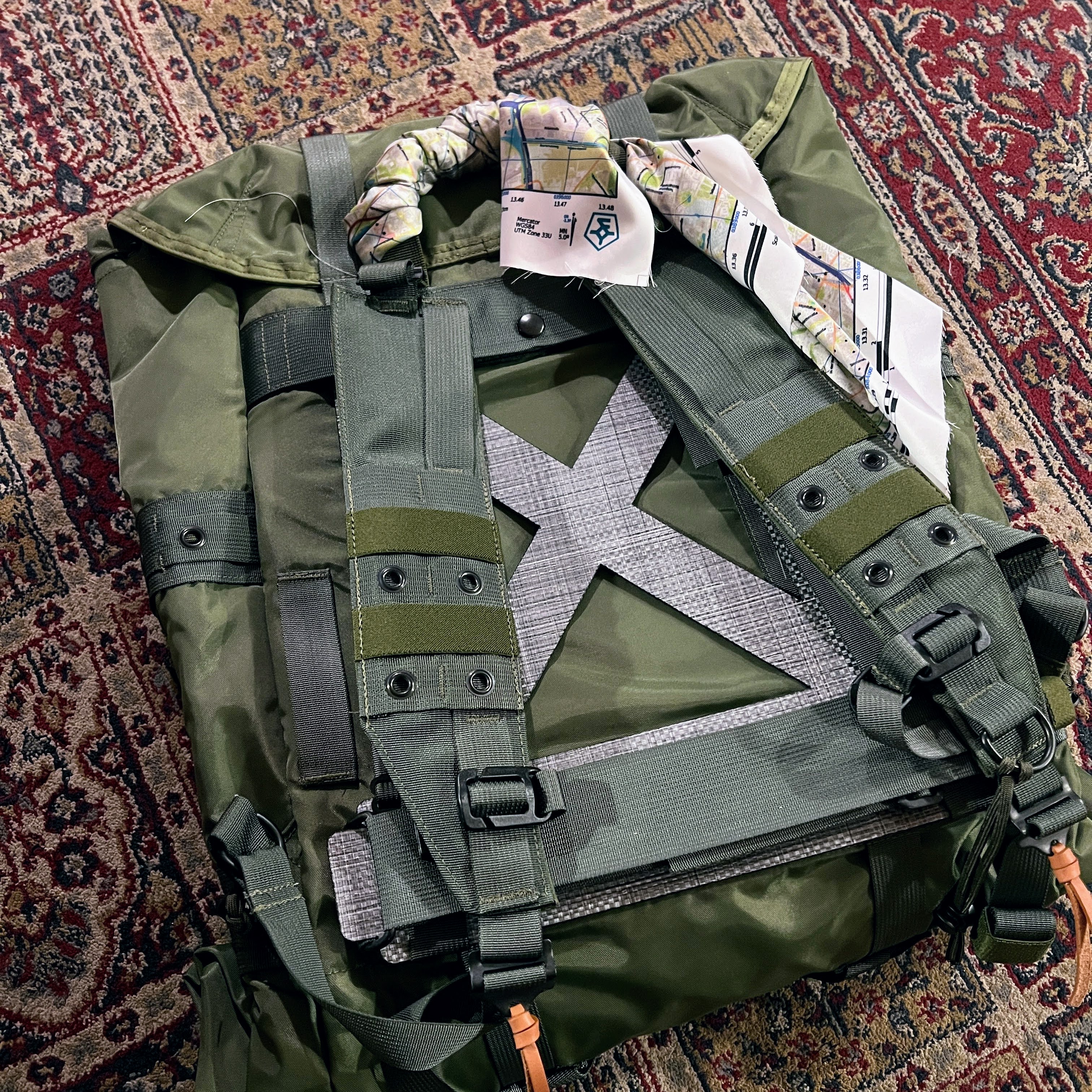
The Berlin escape map wrapped around the handle of the Corbet rucksack by the Observer Collection.
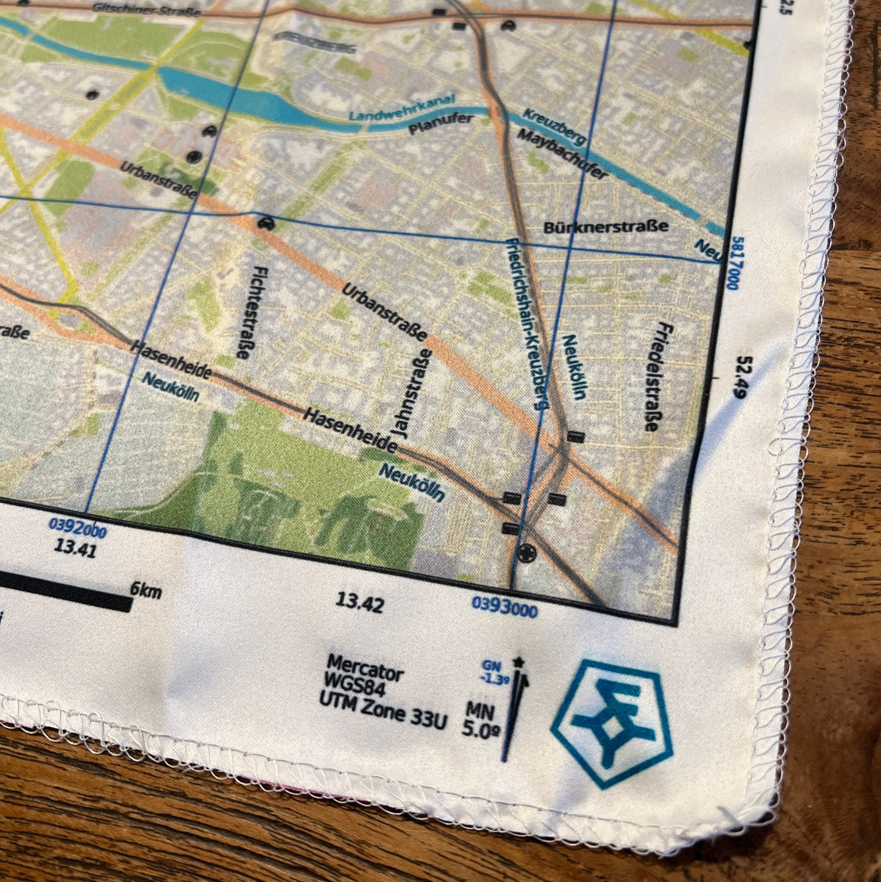
Berlin escape map detail: Inconspicuous branding with the Wndsn logo at the bottom right and no other markings.
The Wndsn escape map can be worn as a scarf or added to other items. The edges are finished with an overlocker stitch and can be cut away to sew the map in order to line a garment or piece of gear.
The Wndsn Cold War Berlin Wall Escape Map is made in Germany and is available via Wndsn.
See also: