Product Spotlight: Wndsn Coordinate Scale Square 55 mm
2026-08-23
I was looking at a topographic map of Berlin, working out a route around Tempelhof Airport. The former airfield is a useful place for this kind of exercise because it is simultaneously simple and awkward: an enormous open shape in the middle of a dense city, easy to recognize on a map, yet large enough that going around it turns small plotting decisions into real walking distance.
That was where the Coordinate Scale Square settled into its role.
A coordinate tool does very little by itself. You put it on a map, align it with the printed grid, read a value or make a mark. Then you move it again. Yet those small operations are where a coordinate becomes a position, where a line on paper becomes a route through Berlin, and where the abstraction of map scale turns back into meters underfoot.
The Wndsn Coordinate Scale Square 55 mm is a small plotting instrument for exactly this kind of work. It carries coordinate scales for 1:25,000, 1:50,000, 1:10,000, and 1:100,000 maps, with an additional 1:24,000 ruler on its outer edge. It measures 55 × 55 mm.
Small, and deliberately so.
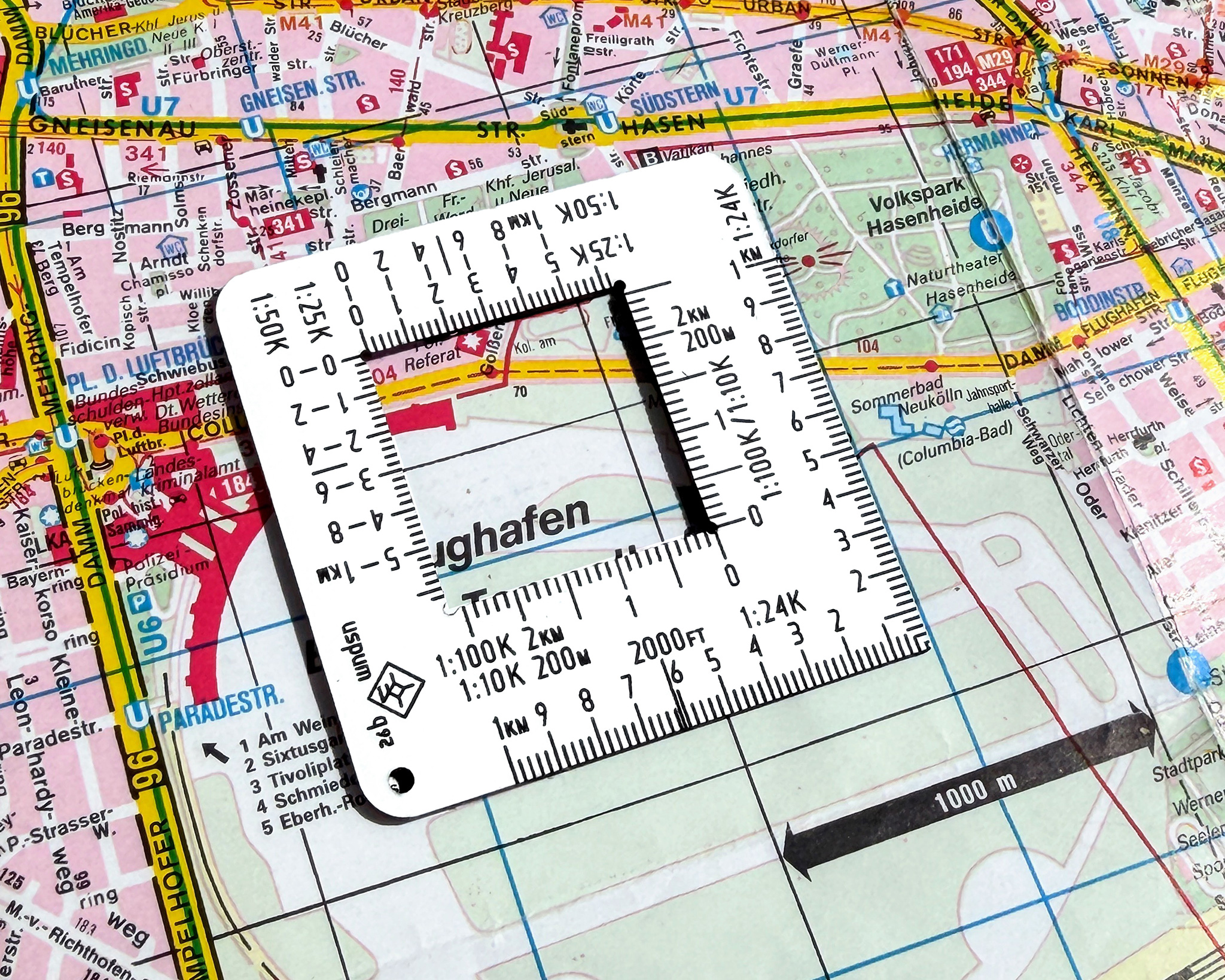
The Wndsn Coordinate Scale Square on a Berlin map.
Why a Square?
Most of the Wndsn instruments began with some practical problem that was annoying enough to deserve a physical solution. The Coordinate Scale Square followed the same route. Maps already contain a measuring system. Grid lines establish position, the map scale establishes proportion, and the task is to extract useful measurements from that printed structure without adding unnecessary complication.
A square gives the hand something definite to work with. Place one edge against the grid. Move inward from the easting. Read upward for the northing. Plot the point. Check it again.
And because the instrument is small enough to sit comfortably within the working area of a folded map, it does not require the whole sheet to be spread across a table. That matters outside. Maps get folded into quarters, held against knees, balanced on bags, turned into the wind and occasionally fought with. A ruler that works beautifully across a drafting desk can become ridiculous in those conditions.
The little square stays close to the point being measured.
There is another advantage to the form, one I did not design into it as a formal function. Looking through the open center reminds me of an old photographic diapositive slide.
That association stuck.
I sometimes find myself holding the Coordinate Scale Square up and looking through it at the environment, simply framing a small piece of the scene in front of me. The object suddenly stops being a ruler for a moment and becomes a viewing frame. A building. A stretch of landscape. Some detail that would otherwise disappear into the surroundings. Old slides used to perform the same act of selection: this rectangle, this moment, this view.
Then it goes back onto the map.
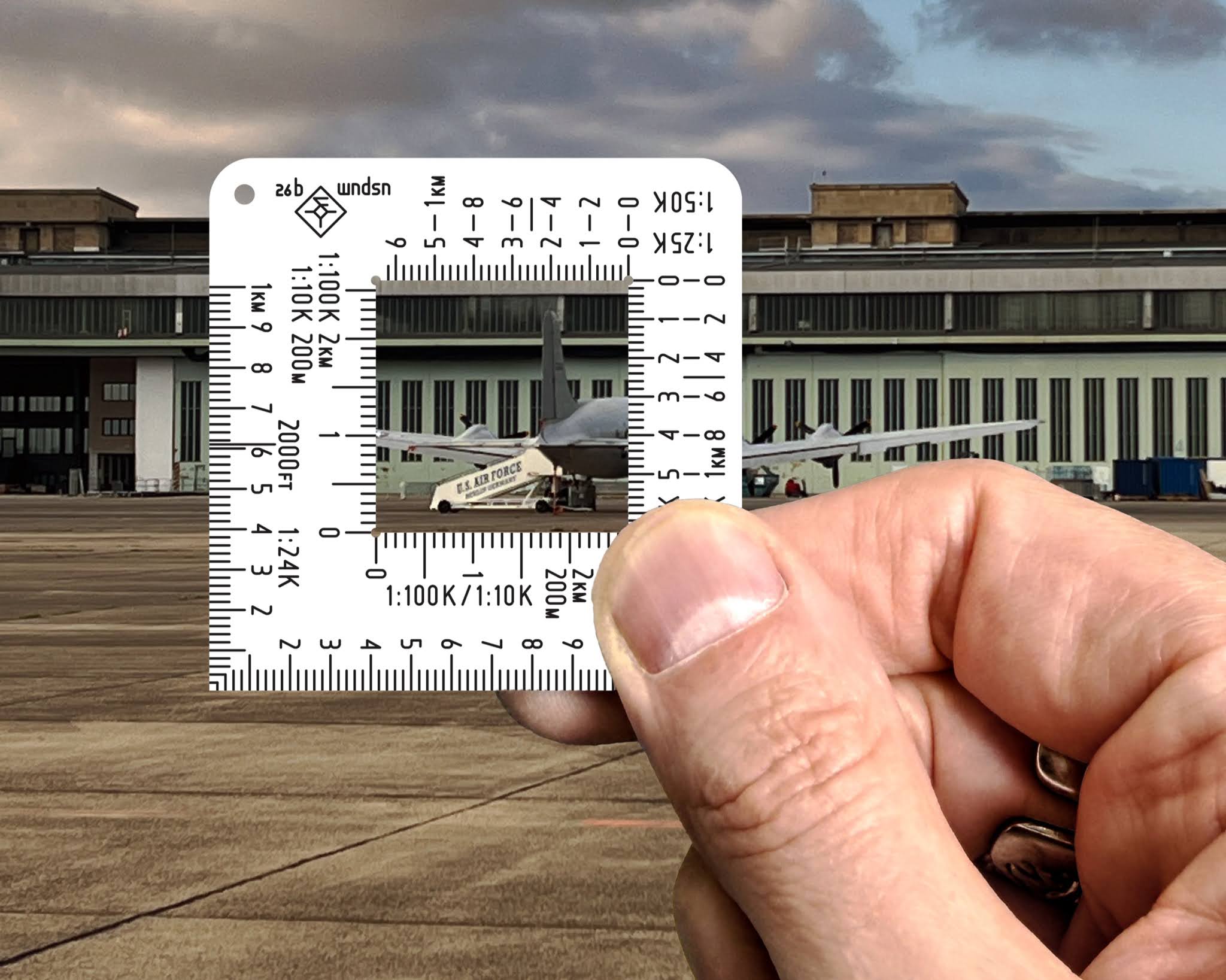
The Wndsn Coordinate Scale Square held up like a diapositive, framing the scene.
The 55 mm Question
The dimensions came from something much less romantic.
A field instrument is useful when you actually have it with you, and 55 mm follows the short dimension of the credit-card format closely. It is also the established width of the Wndsn Telemeter. That gives the Coordinate Scale Square a familiar footprint and, more importantly, lets it disappear into the same places a card can go. A wallet works.
So does a notebook pocket or map case. There is no separate plotting-tool pouch to remember, no long ruler sticking out of a field notebook and catching on everything around it. The square can simply live with the objects that are already being carried.
This sounds almost too mundane to count as design, but dimensions decide whether equipment travels. An instrument left at home has perfect accuracy and zero utility. And 55 mm travels well.
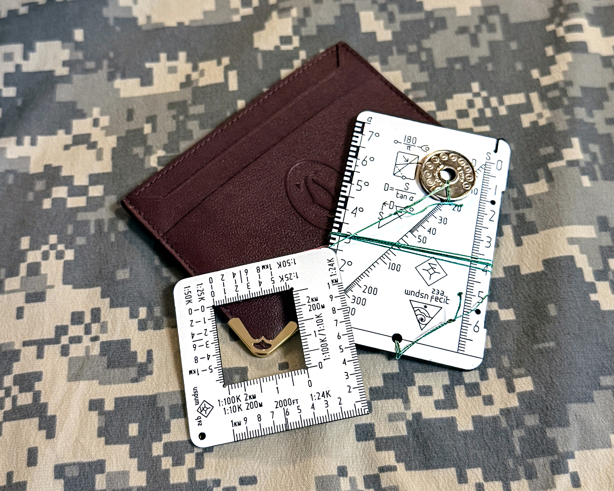
The Wndsn Coordinate Scale Square with a Telemeter on a credit card holder.
Too Thick
The first version was wrong.
I initially made the Coordinate Scale Square from 3.2 mm sandwich acrylic, the same thickness used for the Wndsn Telemeter. It made sense from a production perspective and it gave the little square the reassuring rigidity of the larger instruments.
Then I put it on a map. and it was too thick.
A Telemeter is held away from the body and sighted against an object in the distance, and its thickness helps holding it perpendicular to the target. A map ruler belongs almost flush against paper. At 3.2 mm the edge stood unnecessarily high above the surface and made such a small object feel clumsy, especially when plotting close to a line or trying to use a pencil accurately against the edge.
The material was doing more than the task required.
The production version is 1.6 mm thick. Half the original thickness changed the character of the object. It sits close to the paper now, slips into a wallet more naturally and feels like a map instrument rather than a miniature plate.
This is the kind of adjustment that becomes obvious only when a prototype leaves the drawing and reaches the hand. On screen, 3.2 mm looked perfectly reasonable. On a folded map, it was wrong.
So we sliced it in half.
Several Maps, One Instrument
Map scale determines how much landscape gets compressed onto the sheet. On a 1:10,000 map, one centimeter represents 100 meters on the ground. At 1:100,000, that same centimeter represents a kilometer. The physical distance on the paper stays exactly where it is while the terrain behind it expands by an order of magnitude.
The Coordinate Scale Square carries the scales I wanted available without having to choose a separate plotting tool before setting out. There are scales for 1:10,000 and 1:25,000 maps, plus 1:50,000 and 1:100,000. The outer edge adds the 1:24,000 scale encountered on US topographic mapping.
Once a particular map is in front of you, everything else disappears. You find the appropriate edge and work.
There is a small secondary use here too. The 1:10,000 scale can be pressed into service as an ordinary centimeter ruler. I do this more often than a product specification would suggest. Sometimes the job at hand has nothing to do with plotting coordinates. You simply need to know how many centimeters something is.
Use the scale that is already there.
This kind of crossover is something I like in compact instruments. The markings have a defined purpose, yet the geometry remains available to the person holding the tool. A straight edge stays a straight edge. A square stays square. Graduations can answer questions beyond the one printed in the manual.
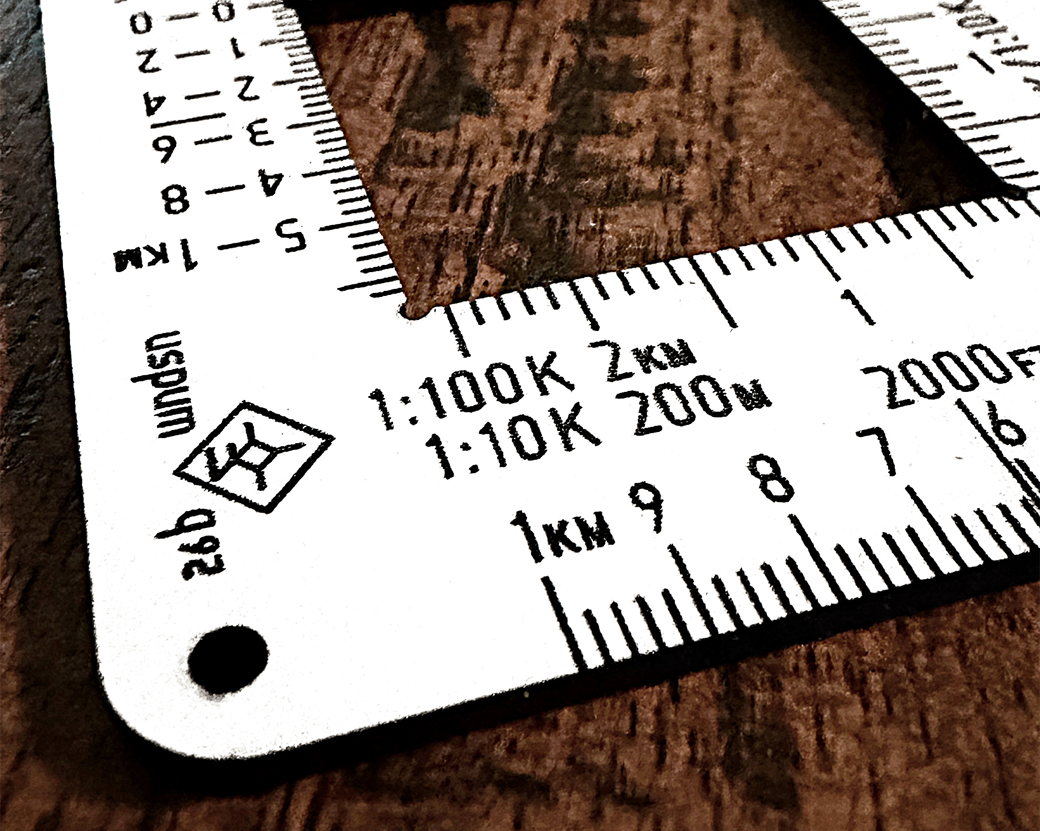
Wndsn Coordinate Scale Square engraving detail.
Reading the Map
A topographic map can become visually noisy very quickly. Contours cross vegetation boundaries. Paths meet grid lines. Labels sit across terrain features, and whichever point you are interested in has an irritating tendency to occupy the busiest part of the sheet.
Transparent plotting instruments solve one problem by letting the map remain visible underneath them, then introduce another because every engraved line on the tool is now competing with every printed line below it.
Wndsn map tools use solid sandwich acrylic instead.
The Coordinate Scale Square has a matte white surface over a black core. Laser engraving removes the outer layer and exposes the dark material beneath, producing the scale markings as part of the object itself. The result has strong contrast, and the opaque material gives the eye a clean edge against the map.
You align, then you read.
The map remains visible where you need it, especially through the central opening, while the scale itself sits against a quiet background. The principle is simple enough that it disappears during use, which is where I want it. There should be no puzzle involved in finding the graduation you need while your other hand is keeping a map from folding itself shut.
The square becomes an interface between two systems of measurement: the grid printed by the cartographer and the coordinate you are trying to establish on the ground.
Back to Tempelhof
Take the Berlin map again.
Tempelhof Airport occupies an unmistakable patch of ground, the old runways and open field forming a huge interruption in the street pattern surrounding it. If I want to plot a route around that space, I can work from grid positions, establish points along the intended path and measure the distances between them before ever putting on a pair of boots.
The map reduces the city. The grid organizes it. The scale gives that reduction a numerical relationship to the real world.
Then the little square sits on top and lets the hand work with all of it.
This is one of the pleasures of physical navigation tools. You remain aware of what is happening. There is a visible chain from position to grid, from grid to coordinate, from paper distance to ground distance. Nothing vanishes behind an interface. If the plotted point looks wrong, you can inspect how you arrived there.
And if the route looks longer than expected, the map can tell you why.
A Small Frame
The Coordinate Scale Square is manufactured in Germany from laser-cut 1.6 mm sandwich acrylic. Its surfaces are matte, its graduations are engraved into the material, and its edges are left square for plotting. Each piece passes through manual production, so minor traces of that process remain visible.
There is something pleasing about tools whose physical size is far smaller than the world they help describe. A 55 mm square can sit over Berlin and tell you where you are. Move it across another map and the same little frame may contain a forest, a mountain flank or a kilometer of open ground. Put it back in your wallet and all of that geometry disappears into the space occupied by a card.
But I keep returning to the diapositive.
Hold the square away from the map and look through the center. Suddenly there is a tiny picture of the world inside it. Move your hand and another appears. For a moment it resembles those old mounted slides, each one reducing a place and a memory to a small illuminated rectangle.
Put it down on the map again and the operation reverses. The little frame now helps turn the miniature back into the world.
Ex Mensura, Scientia.
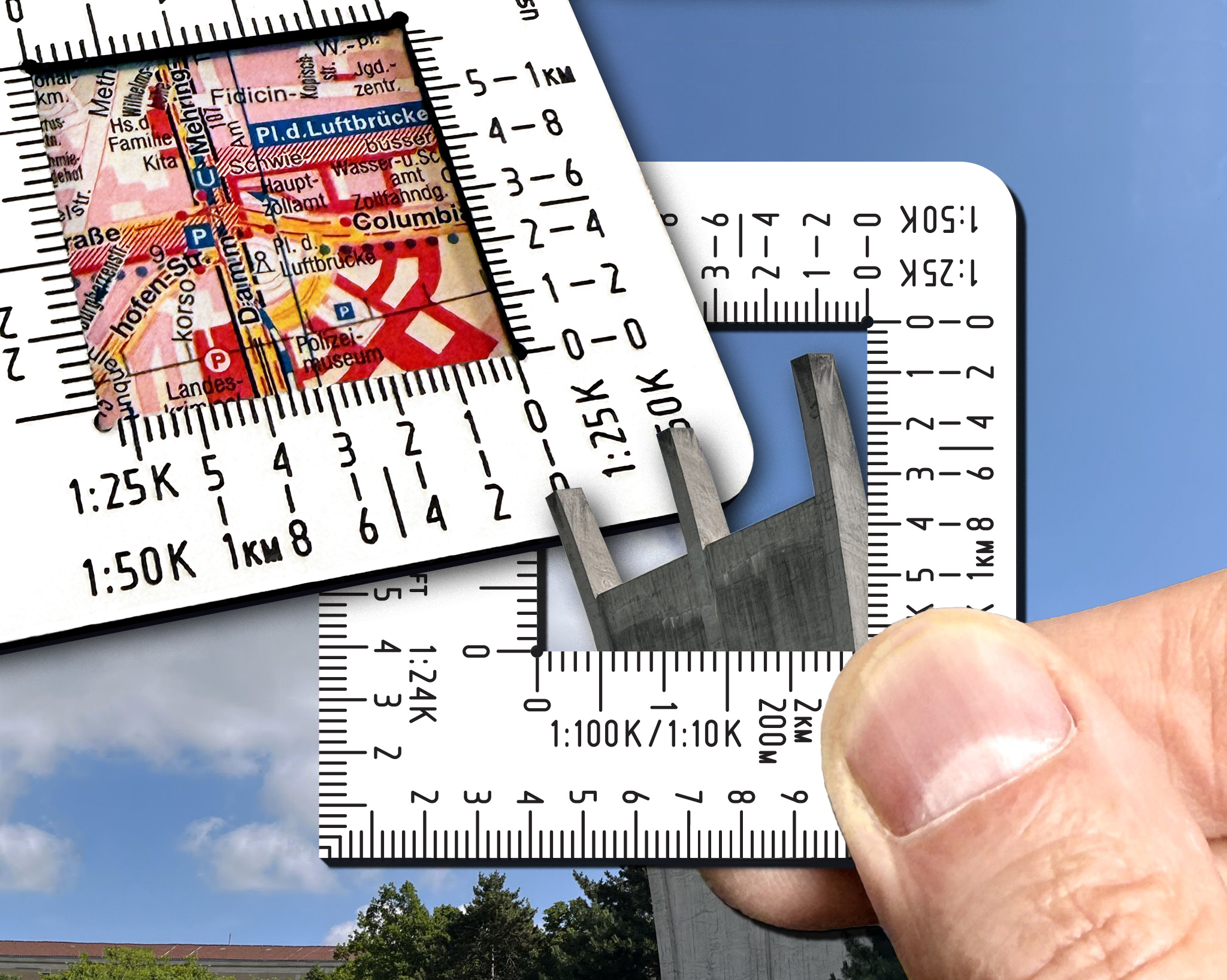
The Wndsn Coordinate Scale Square framing the three prongs of the Tempelhof memorial, and placed over the corresponding map.
The Wndsn Coordinate Scale Square 55 mm is available from the Wndsn Store.